An image taken from the Ramesseum showing Ramesses II at the Battle of Kadesh.
Exodus

The Reed (Red) Sea

After the Israelites escaped Egypt through the Wadi Tumilat, they did something hard to fathom.  Instead of making a clean break down the west coast of the Sinai as they had intended, they turn northward.  They made their way towards the Way of Horus, the military road that runs along the north Sinai.  After that, they “wandered” in the wilderness aimlessly to lure Pharaoh into thinking they were lost (Exod 14:3). From a strategic perspective, this move makes little sense.  The Israelites essentially boxed themselves in.  Pi-Hahiroth was to the west, desert to the south, Pharaoh’s chariots to the east, and their backs to the sea.  Strategically, this was the worst possible position to be in.  Trapped with nowhere to run.   And yet, the sea opened up and the Israelites escaped what would otherwise be certain death. In several sections, the biblical narrative simply calls this body of water the “Sea.”  But some texts (e.g., Exod 13:18 and 15:22) refer to it as the yam suf (יַם סוּף).  The translation of yam suf as the “Red Sea” entered into English Bibles through the Greek Septuagint (ca. 250 BCE) translation Ερυθρὰ θάλασσα. However, in Hebrew yam suf means “Sea of Reeds.” 
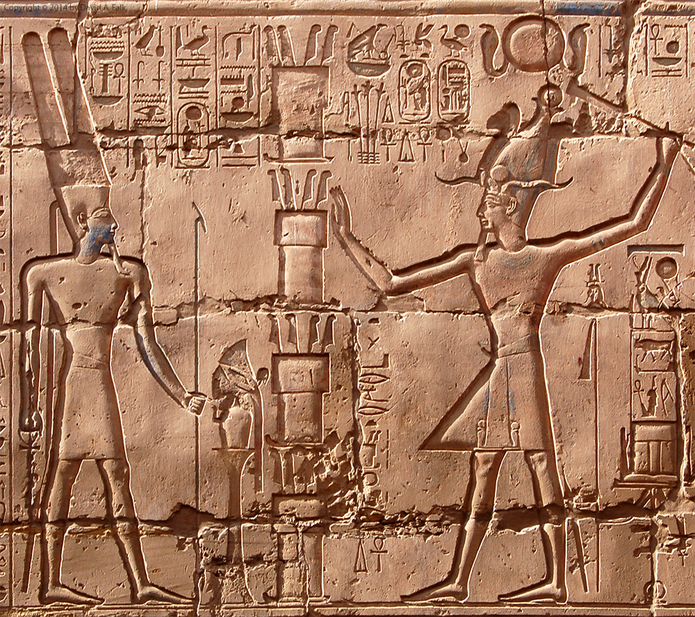
This place name most likely comes from the Semitic-Egyptian pȜ ṯwfy, “The Reeds.”  Papyrus Anastasi III (2:11-12) mentions this body of water and states that the “foliage and greenery” of Pi-Hahiroth was nearby (Papyrus Anastasi III, 3:3).  Thus, the pȜ ṯwfy was probably one of the lakes (possibly Lake Ballah or Lake Timsah) that were part of the marshy area along what is now the Suez Canal. P. Anastasi III mentions three toponyms (Piramesses, Pi-Hahiroth, and the “Reeds”) in a geographic sequence similar to that found in Exodus.  This suggests a strong correspondence between what the Egyptians knew about the region and the biblical record of the sites.
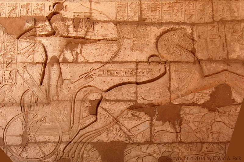
Seti I relief from Karnak Temple (Illustration from A. H. Gardiner, JEA 6 [1920], pl. 11), with the Migdol.
Exodus

The Tower Migdol

After the Israelites fled Pharaoh, they took the Wadi Tumilat to leave Egypt but God told them to double back (Exod 14:1).  So they moved northward camping between Pi-Hahiroth, the sea, and Migdol (Exod 14:2). Migdol was one of the fortresses on the Way of Horus.  The Way of Horus was the road that hugged the northern coast of the Sinai peninsula.  Several fortresses on this road controlled the flow of traffic from the Levant. The Egyptian version of this name, mˁktir actually derives from a Semitic loan word מגדל, “tower”.  The location of Migdol is unknown, but the name appears in a couple of extra-biblical sources. Papyrus Anastasis V (20:2-3) implies that the fortress was built by Pharaoh Seti I of the 19th dynasty.  This is the same king who first established the city of Piramesses.  According to a map of the Way of Horus found at Karnak Temple, Migdol (Karnak map, “E”) is east of the Dwelling of the Lion (Karnak map, “D”). The Dwelling of the Lion has been located at Tell el-Borg, near the north coast of the Sinai Peninsula and the estuary of the Ballah Lakes. The Egyptians reconstructed the site multiple times, as evidenced by its multiple phases including a destruction layer. Eliezer Oren excavated a different Migdol, which survived as a fortress into Roman times, but this site has no Ramesside period remains. Thus, if this is “the same” Migdol, then the site migrated over time.
A bronze figure of a deity from Alalakh.
Exodus

Baal-Zephon, Lord of the North

After the Israelites camped before Pi-Hahiroth, they wandered in the desert near the fortress Migdol.  They camped between Migdol, Pi-Hahiroth, the Reed Sea, and a looking post nearby known as Baal-Zephon. Unlike the previous Egyptian toponyms, Baal-Zephon has a Semitic etymology.  Baal is common to many Semitic languages and means “lord,” a term often used for a god.  The name, Baal, was used during the Old Babylonian period for a variety of deities including Marduk (bel) but is perhaps best known from the Bible as an epithet for the northwest Semitic storm-god (Hadad/Adad). The biblical text parallels “before Pi-Hahiroth” and “before Baal-Zephon,” implying that the two sites are adjacent (Exod 14:9).  Papyrus Sallier IV mentioned Ball-Zephon in the following:
To Amūn of the temple of the gods; to the Ennead that is in Pi-Ptaḥ; to Baˁalim, to Ḳadesh, and to Anyt; (to) Baˁal Zephon (bˁr-ḏȜpn), to Sopd. Papyrus Sallier IV (vs. 1:6)
The Hyksos who worshipped the storm god associated this god with the Egyptian storm god, Seth.  The Egyptians continued to use this association after the Hyksos left Egypt.  Given that the author of Papyrus Sallier IV wrote the toponym Baˁal-Zephon with the Seth character; Baal in this toponym may be a reference to Seth. The second element of the toponym, the word zephon, means “north” in Semitic languages. However, Zephon by itself also appears as a toponym in Amarna Letter 274, most likely as a name of a Levantine city. Thus, it is unclear whether zephon in Baal-Zephon refers to a direction, yielding “Baal of the North,” or a place, “Baal of (the city) Zephon.”
A relief of Montu at Tod with two Wadjet amulets
Exodus

Pi-Hahiroth, “Estate of the Temple of the Wadjet” by any other name

After Pithom, the Israelites camped before the fortress of Pi-Hahiroth (Exod 14:2).  The origin of the name Pi-Hahiroth comes from the Egyptian pr-ḥwt-ḥrt.  The toponym pr-ḥwt-ḥrt appears in one extra-biblical text, Papyrus Anastasis III:
The (Sea of) Reeds (pȜṯwfy) comes to papyrus reeds and the (Waters-of)-Horus (pȜḥr) to rushes.  Twigs of the orchards and wreaths of the vine-yards [ … ] birds from the Cataract region.  It leans upon [ … ] the Sea (pȜ ym) with bg-fish and bȗrἰ-fish, and even their hinterlands provide it.  The Great-of-Victories youths are in festive attire every day; sweet moringa-oil is upon their heads having hair freshly braided.  They stand beside their doors. Their hands bowed down with foliage and greenery of Pi-Hahirot (pr-ḥwt-ḥrt) and flax of the Waters-of-Horus.  The day that one enters (Pi)ramesses (wsr-mȜˁ-rˁ stp-n-rˁ) l.p.h., Montu-of-the-Two-Lands. Papyrus Anastasis III (2:11-3:4)
This document, dated to the third year of Ramesses II’s successor, Merneptah (ca. 1222-1212 BCE), locates Pi-Hahiroth on the way from the Sea of Reeds (pȜ ṯwfy) towards Piramesses.  It appears as though Pi-Hahiroth was probably on the south coast of the Sea of Reeds in a marshy area on the edge of the desert.  While no one knows the exact location of Pi-Hahiroth, it was probably is in close proximity to Migdol and Baal Zephon. Egyptologists have long struggled with the meaning of the pr-ḥwt-ḥrt toponym.  And early Egyptologists suggested that it might mean “House of (the goddess) Hathor,” assuming that the word ḥrt was an unusual or mistaken spelling of Hathor. The toponym follows Egyptian convention beginning with the hieroglyphic pr-ḥwt, “estate of the temple” or “house of the precinct.” It ends with the goddess character indicating that the final element, ḥrt, is theophoric. William F. Albright suggested that it might mean “the mouth of the canals,” which he suggested was perhaps a Semitic etymology of the Egyptian Pi-Ḥ-r-t, yet this creative solution ultimately did not solve the problem of the theophoric name.  He suggested that Heret was the name of a Semitic goddess.  The problem is that, even though the name could mean “Estate of the Temple of (the goddess) Heret,” no such goddess is known. Therefore, Albright’s proposal was not a tenable solution to the problem. I believe that ḥrt is an abbreviated spelling of ḥry(t)-tp, “the one who is on top.” The term ḥry(t)-tp is one of the epithets of the Uraeus serpent goddess, Wadjet, and therefore, the name would mean, “Estate of the goddess who is on top (=Wadjet).”  This solution retains the theophoric aspects of the toponym and is consistent with known examples of the Wadjet epithet (e.g. Karnak Rhetorical Stela [KRI V 89.10]).
Mud brick storage magazines at the Ramesseum.
Exodus

Pithom, “House of Atum”

Pithom, also called Etham, was located in the Wadi Tumilat to the east of the Nile Delta.  Pithom was the third destination of the Israelite exodus (Exod 13:20, Num 33:6-8).  It was one of the cities where the Israelites built for the Egyptians mud brick storage magazines like those at the Ramesseum (see photo above). In ancient times, the road between Piramesses and Pithom would have been about 65 km (40 mi) or about 2 days of travel by foot.  The wadi provided way stations for semi-nomadic tribes from the Levant.  And like the delta in general, the city had a significant Levantine Asiatic population during the Second Intermediate Period. A recent excavation of Tell el-Retabah showed that the site was only sporadically occupied at the beginning of Dynasty 18.  During Dynasty 19, Ramesses II built new fortifications at Tell el-Retabah to control the flow of Asiatics into Egypt.  He also built a Temple of Atum, from which the site gained the epithet pr-tm ṯkw.  The meaning of this new epithet, Pithom/pr-tm is “house of Atum,” named after a creator god.  The city fell into disuse during the Saite period (670-525 BCE). During the Old Kingdom/First Intermediate Period, tribes of Levantine Asiatics sought entry into Egypt via the Wadi Tumilat and Pithom.  This was especially true during times of famine.  When they left Egypt, the Israelites simply retraced the path that many Asiatics took when they entered into Egypt.
Exodus

Sukkot, Camping West of Pithom

The Torah states that Sukkot was the next stop for Israelites after leaving Egypt (Exod 13:20; Num 33:6-7).  Some scholars point to the similarity between the modern Arabic name Tell el-Maskhuta and the biblical name. The only problem is that Tell el-Maskhuta is east of Tell el-Retabah (Pithom).

From the exodus itinerary, it is clear that the biblical author pictured Sukkot as west of Pithom.  The name should therefore not be understood as the name of a city.   But like Goshen, the name was probably a regional designation, describing the area between Piramesses and Pithom.

This suggestion is consistent with the use of Tjeku in Papyrus Anastasis VI (54-56):  “We have finished letting the Shasu tribes of Edom pass the Fortress of the House of Merneptah, l.p.h., which is in Tjeku, to the pools of Pithom of Merneptah, which are in the Tjeku, in order to sustain them and sustain their flocks by the pleasure of Pharaoh, l.p.h.”

According to this papyrus, the Shasu traveled from the Fortress of Merneptah to Pithom, both of which were in Tjeku.  This would likely place the Israelite encampment of Sukkot near the entrance to the wadi, possibly near the modern town of Abou Hammad.

The Hebrew name Sukkot is related to the term that means “booths.”  As such, Sukkot may have only been the location of a temporary camp site.  In other words, a way station with limited water and resources.

Exodus

Pi-Ramesses, City on an Island

The Bible mentions the cities of Pithom and Ramesses as the places where the Israelites made “storage cites” (Exod 1:11).  Exod 12:37 and Num 33:3-5 point to Pi-Ramesses as the starting place of the exodus.  So what do we know about the early history of the island city of Pi-Ramesses?

The only city of the ancient world with name “Ramesses” was Pi-Ramesses, the “house of Ramesses.”  Labib Habachi identified Pi-Ramesses at the archaeological site of Qantir.  Qantir is located 2 km east of Avaris, the former Hyksos capital. 

Seti I (ca. 1303-1288 BC) founded Pi-Ramesses as a royal residence.  Ramesses II (ca. 1288-1222 BC) expanded the city to become capital of Egypt.  Papyrus Anastasi III (1:12) dating to Merneptah’s 3rd year spells Pi-Ramesses with the birth name of Ramesses II, “Ramesses Meriamun.”

The Egyptian kings built Pi-Ramesses to keep an eye on the large Semitic population at Avaris.  The city also located in the region where the Ramessides had their power base.  The two cities existed together until Avaris was abandoned during Dynasty 19.

Ground-penetrating radar and Caesium-Magnetometry surveys done in 1996, 2003, and 2008 revealed no earlier remains beneath the Dynasty 19 city.  Moreover, the city of Pi-Ramesses was an island surrounded by water on all sides.

These facts show us two things.   (1) The Israelites lived near but not in Pi-Ramesses itself.  (2) The Exodus could not have occurred earlier than the reign of Ramesses II.  Thus, the Israelites probably gathered for the exodus at a staging area between Avaris and Pi-Ramesses.  Avaris afterwards ceased being a viable city when it was abandoned by the Israelites.